Hurricane Preparedness
2016 ATLANTIC HURRICANE SEASON FORECAST
It’s that time of year here in Florida when we watch the weather rather closely. That is because it’s The Atlantic Hurricane Season which runs from June 1 through November 30 (encompassing the Atlantic Ocean, Caribbean Sea, and Gulf of Mexico). Luckily for us, the 2016 Atlantic Basin hurricane season is expected to have average activity close to the median levels from 1981 to 2010.
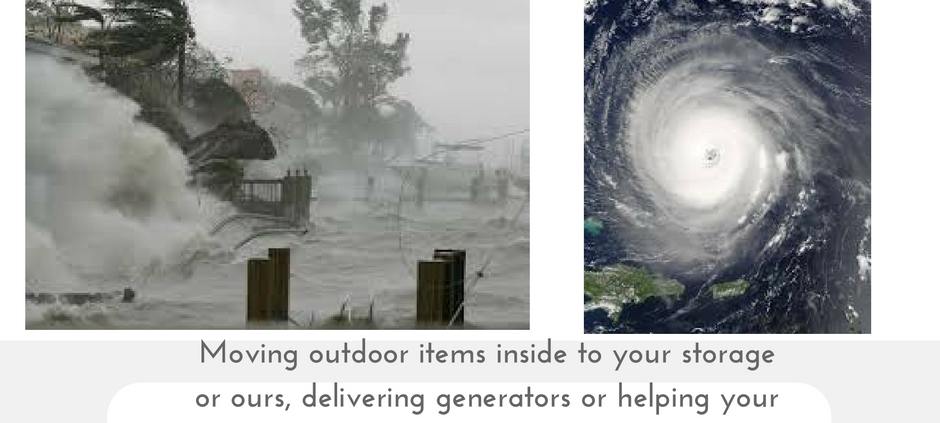
However, even tropical storms can cause a lot of damage and that is why White Glove Moving & Storage strives to assist our friends and neighbors when it comes to the heavy lifting. If there is a storm brewing, we can help bring all outdoor patio furniture, fixtures and accessories into our climate controlled storage and it can stay as long as short as needed with delivery service available. Want your stuff simply moved into your garage while you are away; we can do that too! Perhaps you have your parents that need some assistance moving and you are not close by; we’d be honored to lend a helping, caring hand. Even assistance with crating and packing pieces that you may want shipped to wherever you are are skills we can provide and the best part is we have no minimums unlike other movers who charge for 4 hours even it only takes them two. Should you have just some general moving questions; we are always here and willing to navigate you through the process. In the meantime, here are some interesting facts to share:
HURRICANE FORECAST AND COUNTS, JUNE 2016
| Hurricane Forecast | Expected Count 2016 | Median Count for 1981 to 2010 |
|---|---|---|
| Named Storms | 12 | 12 |
| Named Storm Days | 50 | 60.1 |
| Hurricanes | 5 | 6.5 |
| Hurricane Days | 20 | 21.3 |
| Major Hurricanes | 2 | 2 |
| Major Hurricane Days | 4 | 3.9 |
| Accumulated Cyclone Energy (ACE) | 90 | 92 |
| Net Cyclone Activity | 95% | 103% |
- The probability for major hurricane landfall on the entire coastline of the United States in 2016 is 50% (the average for the last century is 52%).
- The probability for landfall on the East Coast including Florida is 30% (the average for the last century is 31%).
- The probability of landfall for the Gulf Coast is 29% (the average for the last century is 30%).
How are hurricanes classified and what are hurricane categories?
A. The Saffir-Simpson Hurricane Scale is a 1-5 rating based on the hurricane’s present intensity. This is used to give an estimate of the potential property damage and flooding expected along the coast from a hurricane landfall. Wind speed is the determining factor in the scale, as storm surge values are highly dependent on the slope of the continental shelf in the landfall region. Wind speeds are measured using a 1-minute average.
| Saffir-Simpson | Wind (mph) | Hurricane Example |
|---|---|---|
| Category One | 74 – 95 | Allison (1995), Danny (1997) |
| Category Two | 96 – 110 | Bonnie (1998), George (1998), Gustav (2002) |
| Category Three | 111 – 130 | Roxane (1995), Fran (1996), Rita (2005) |
| Category Four | 131 – 155 | Opal (1995), Iniki (1992), Charley (2004), Katrina (2005) |
| Category Five | 156 + | Andrew (1992) |
Q. What causes a hurricane to happen?
A tropical ocean and its atmosphere create the right conditions for a hurricane. Hurricanes draw their energy from the warm surface waters of the tropics (usually above 27°C, or about 81°F) and the latent heat of condensation. Powered by heat from the sea, they are steered by the easterly trade winds and the temperate westerlies, as well as by their own ferocious energy. Around their core, winds grow with great velocity, generating violent seas. Moving ashore, they sweep the ocean inward while spawning tornadoes and producing torrential rain and floods. When hurricanes move over cold water or over large landmasses, they can die out quickly because they lose the power of the heat and condensation.